Longer hikes in the Bruce Peninsula, Ontario


The beautiful beach at Halfway Log Dump.

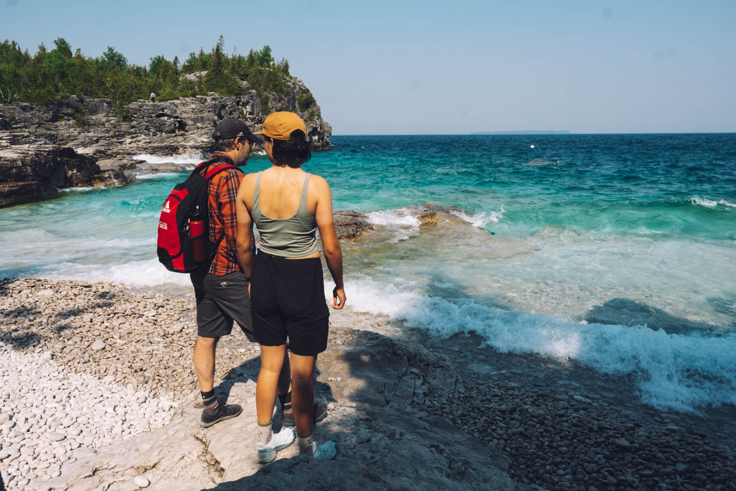
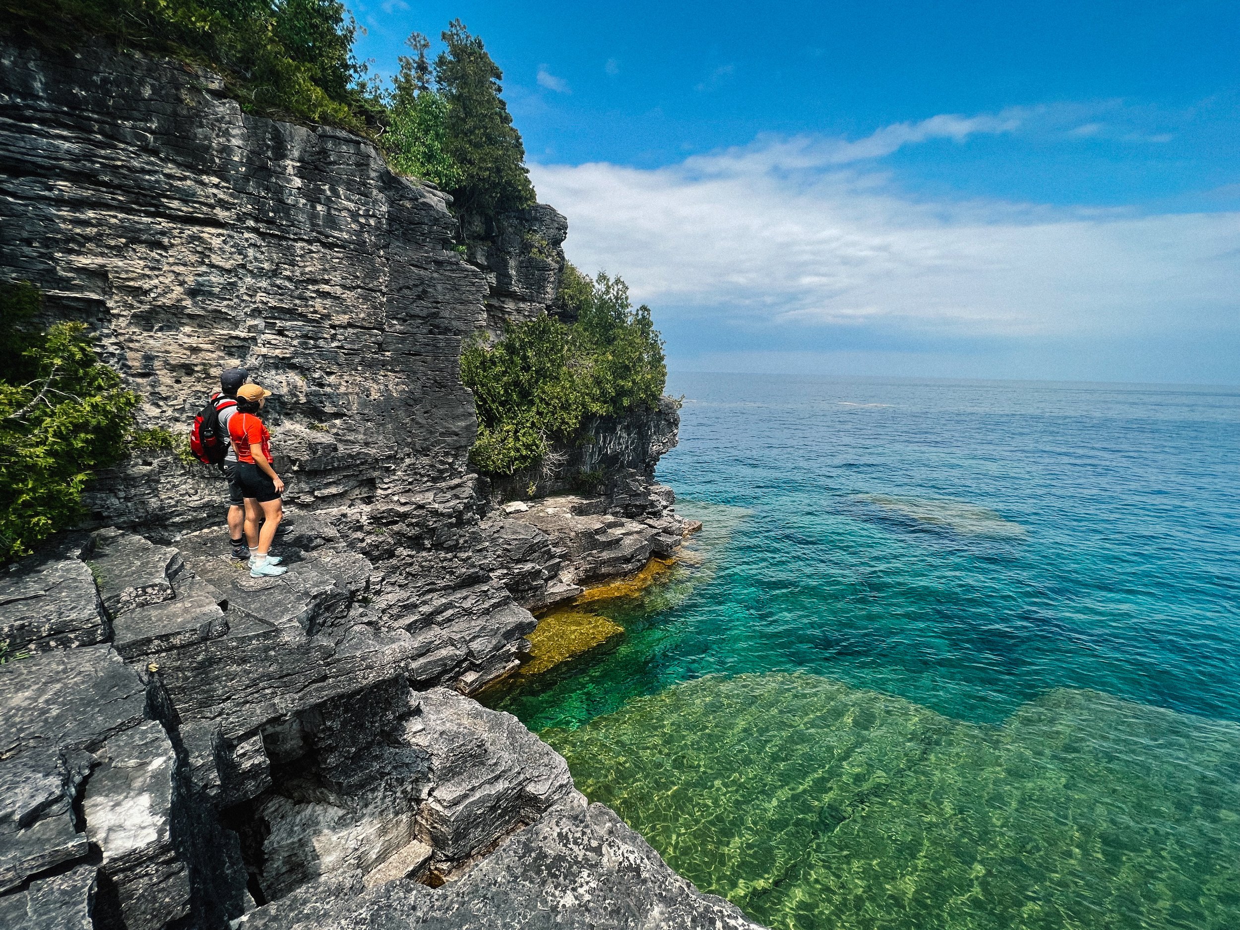
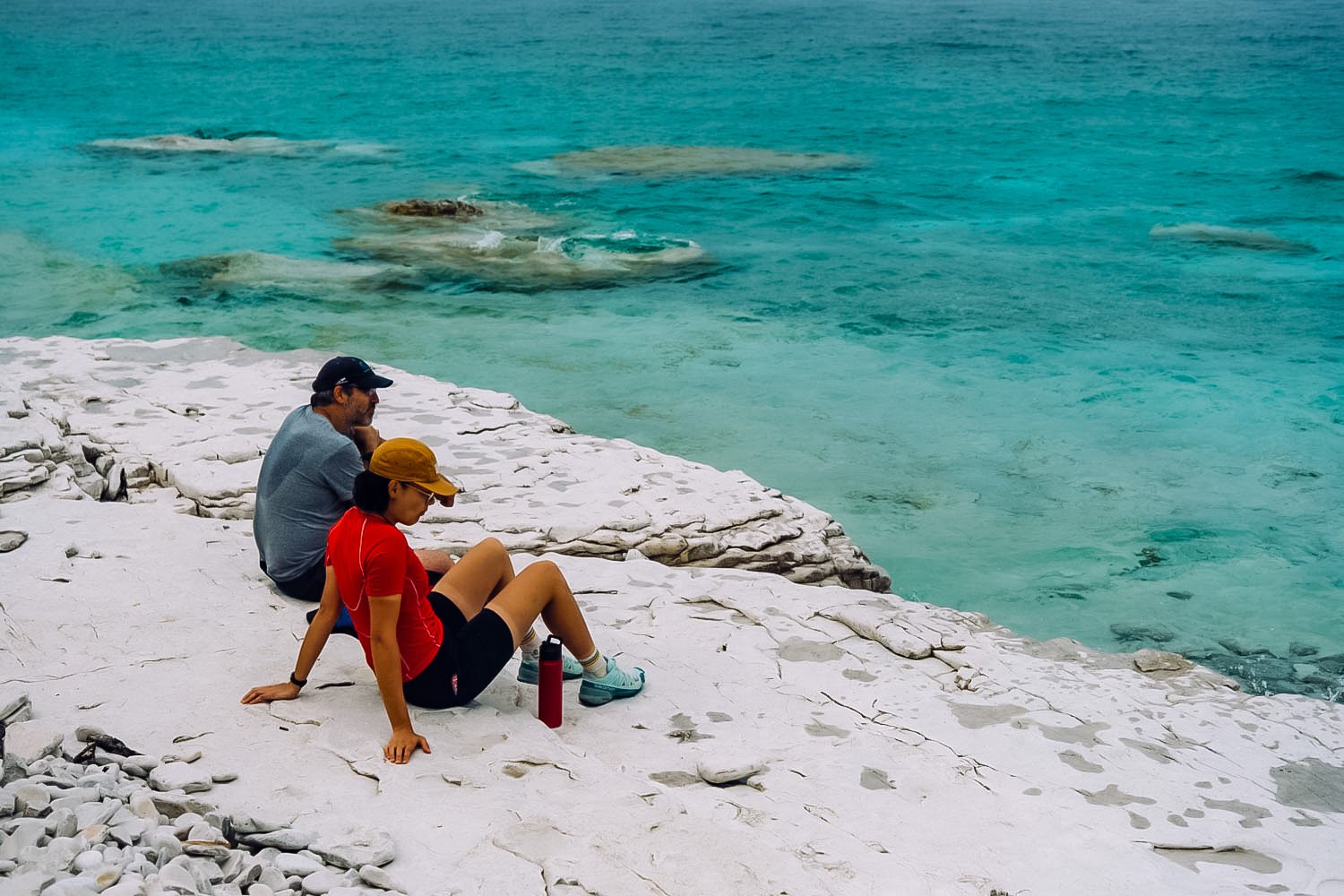
Indian Head Cove, near the Grotto

The Bruce Peninsula National Park is another place where you have to reserve months in advance to snatch a campsite. The campsites might only be $23 per night, but don’t be fooled, you have to pay extra for the entry fees and extra for a tow vehicle. It’s pricey for an unserviced campsite. The big plus is that you don’t need to reserve and pay for a parking spot (and be limited to 4 hour slots only) to hike to the Grotto (the most popular attraction everybody wants to see).

Indian Head Cove near the Grotto

Rocky Shore Beach. Day 1 hike (see below).

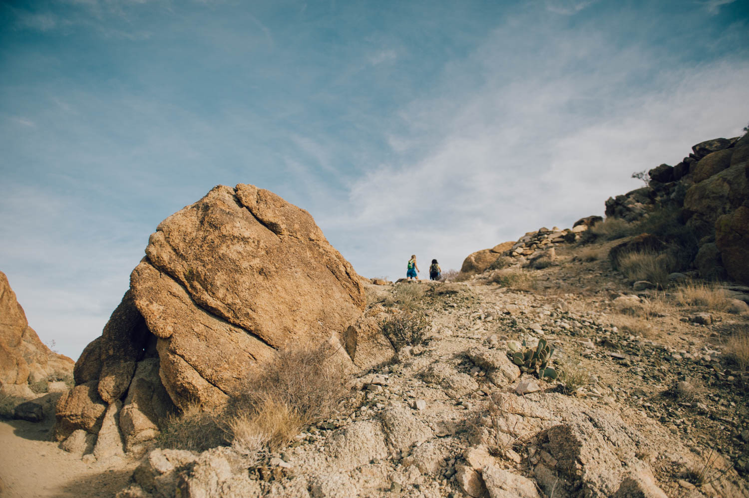
Overhanging Point (a viewpoint on Day 1 hike).

 Our goal was to hike everywhere from the campsite. Since we had wanted to visit the area for a long time, we reserved 4 nights during the week at the beginning of June and the campground was almost empty. Needless to say, the place is a zoo in the high season. Expect to see stupid behaviors and natural selection in action at the Grotto - 15-20 minutes will likely be plenty and you will desperately want to leave.

Halfway Rocky Point (at the beginning of Day 2 hike)

Unfortunately, there isn’t much info on longer hike options, so we created our own. That’s mostly why I’m sharing this post. If, like us, you don’t like to sit around much, 3 nights will be plenty.

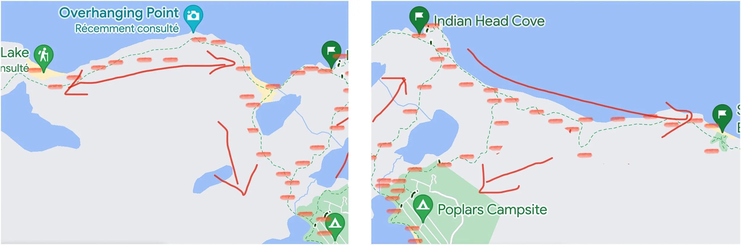
Very badly handdrawn indications of the hikes we did, but since they do not exist, I figured it’s better than nothing. Day 1 on the left and Day 2 on the right.

Day 1: Hike to the Grotto and continue to the left along the coast on the Bruce Trail all the way to Rocky Point (Loon Lake). It’s a beautiful 10 km round-trip and we were by ourselves as soon as we left Boulder Beach. On the way back, take the Marr Lake Trail from Boulder Beach.

Day 2: Hike to the Grotto and take the other side (right) of the Bruce Trail all the way to Stormhaven backcountry campsites. On the way back, take Horse Lake trail to the campground.

Perfect lunch spot by the water at Stormhaven backcountry campground (Day 2 hike)

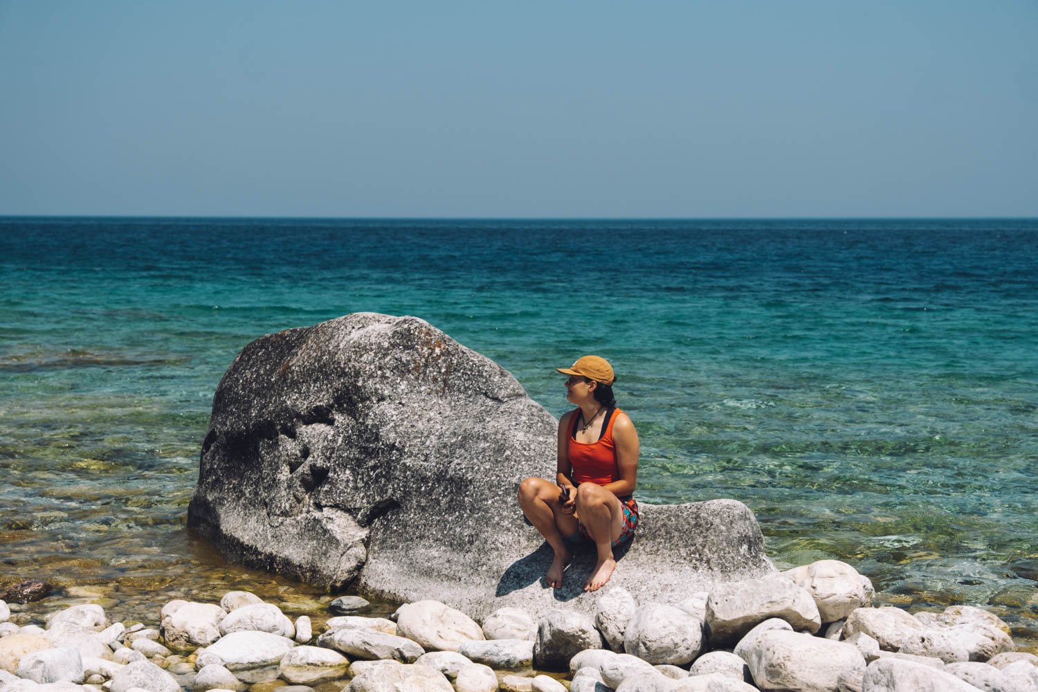
Day 3: Go explore Halfway Log Dump. You have to drive there from the campground (20 min) and hike less than 1 km to the beach. From there, explore the coast. We went left (upper peninsula) and found a cool bouldering area. If you want to go for a longer hike, you could go right on the Bruce Trail (lower peninsula) and hike to High Dump backcountry campsite.

Halfway Dump Beach

Day 4: get out of there before the weekend crowd gets here.

P.S.: All those hikes require walking on cobble beaches and rocky (slippery) terrain.


Death Valley National Park

Zabriskie Point is the Delicate Arch of Death Valley National Park and people gather there at sunset. Being only 15 minutes away from the main Furnace Creek area by car, it is undeniably one of the most popular spots. It is only a 0,1 mile hike up a…

Zabriskie Point is the Delicate Arch of Death Valley National Park and people gather there at sunset. Being only 15 minutes away from the main Furnace Creek area by car, it is undeniably one of the most popular spots. It is only a 0,1 mile hike up a steep paved path to the viewpoint. Bring warm clothes if it is cold, it can get crazy windy there.

Zabriskie Point was named after Christian Zabriskie who was the general manager of the Pacific Coast Borax Company, which was huge in Death Valley during the borax mining days. The view has been featured in many pop culture references as well, with …

Zabriskie Point was named after Christian Zabriskie who was the general manager of the Pacific Coast Borax Company, which was huge in Death Valley during the borax mining days. The view has been featured in many pop culture references as well, with the most notable being the Joshua Tree album cover for the band U2.

Most people know that Badwater Basin in Death Valley National Park is the lowest point in North America (282 ft below sea level), but there's something even more fascinating about that place. When rainstorms flood the valley bottom like it did in th…

Most people know that Badwater Basin in Death Valley National Park is the lowest point in North America (282 ft below sea level), but there's something even more fascinating about that place. When rainstorms flood the valley bottom like it did in the last few weeks, the salt expanse is covered with a thin sheet of standing water. Each newly-formed lake does not last long, because the 1.9 inches of average rainfall is overwhelmed by a 150-inch annual evaporation rate. This means that even a 12-foot-deep, 30-mile-long lake would dry up in a single year!!! How crazy is that?

From the parking lot, you can see the sea level sign that is located 280 feet above you on the adjacent mountain. It really puts in perspective how low you are when you see it compared to the mountain.

From the parking lot, you can see the sea level sign that is located 280 feet above you on the adjacent mountain. It really puts in perspective how low you are when you see it compared to the mountain.

Look at those cool salt crystals! You can even taste them!

Look at those cool salt crystals! You can even taste them!

As soon as you enter the walk out on the platform you are immediately greeted with a huge lake of what looks like snow. This water is so high is salt content that almost nothing can actually live there. The salt flat itself is 5 miles long. Badwater…

As soon as you enter the walk out on the platform you are immediately greeted with a huge lake of what looks like snow. This water is so high is salt content that almost nothing can actually live there. The salt flat itself is 5 miles long. Badwater Basin is a truly unique place to stop. You don’t need a lot of time here, but it is worth checking out. Also note that it is very often windy there.

Golden Canyon is one of the many sites where different parts of the original Star Wars movies were filmed. It is the most popular hike in all of Death Valley National Park and is a little over 3 miles round trip, depending on where you stop. The par…

Golden Canyon is one of the many sites where different parts of the original Star Wars movies were filmed. It is the most popular hike in all of Death Valley National Park and is a little over 3 miles round trip, depending on where you stop. The parking lot is about 10 minutes South of Furnace Creek.

It has gaping canyons, massive boulders, waves of plantless terrain and even a large red rock called the Red Cathedral at the end. You can totally picture a few stormtroopers appearing around a boulder. You can see some of the reconstructed scenes v…

It has gaping canyons, massive boulders, waves of plantless terrain and even a large red rock called the Red Cathedral at the end. You can totally picture a few stormtroopers appearing around a boulder. You can see some of the reconstructed scenes vs the original scene here.

Approaching the Red Cathedral (in the back).

Approaching the Red Cathedral (in the back).

After leaving Death Valley from the south west road, we decided to stop to visit another geologically interesting place near Searles Lakes. When you visit Trona Pinnacles, you cannot help but feel like you are on the moon or on another planet. The u…

After leaving Death Valley from the south west road, we decided to stop to visit another geologically interesting place near Searles Lakes. When you visit Trona Pinnacles, you cannot help but feel like you are on the moon or on another planet. The unusual landscape is made up of more than 500 spires, some as high as 140 feet, rising from the bed of the Searles Dry Lake basin. The pinnacles vary in size and shape from short and wide to tall and thin, and are composed primarily of calcium carbonate (tufa), like those found in Mono Lake. The pinnacles were formed underwater from 10,000 to 100,000 years ago when Searles Lake was one of a chain of interconnected Pleistocene lakes stretching from Mono Lake to Death Valley.

The Trona Pinnacles are not in Death Valley, they are truly in the middle of nowhere, about 25 minutes east of Ridgecrest, and are one of those places that have to be seen to be believed. Like the Alabama Hills, it is hard to do justice to the sheer…

The Trona Pinnacles are not in Death Valley, they are truly in the middle of nowhere, about 25 minutes east of Ridgecrest, and are one of those places that have to be seen to be believed. Like the Alabama Hills, it is hard to do justice to the sheer beauty of these massive rock structures that jot a landscape that is almost entirely barren and flat.

The Pinnacles are recognizable in more than a dozen movies. Over thirty film projects a year are shot among the tufa pinnacles, including backdrops for car commercials and sci-fi movies and television series such as Battlestar Galactica, Star Trek V: The Final Frontier, Disney's Dinosaur, The Gate II, Lost in Space, Planet of the Apes, and more recently the movie Holes.

There is a short half mile hiking trail, but you can drive around easily in a 4 x 4 vehicle to see the formations. They were more impressive from afar in my opinion. There are designated camping spots and the area is very well defined with rocks to …

There is a short half mile hiking trail, but you can drive around easily in a 4 x 4 vehicle to see the formations. They were more impressive from afar in my opinion. There are designated camping spots and the area is very well defined with rocks to prevent driving over the fragile areas. Please set up camp only where there is already a fire ring outside of the rock-fenced areas. There was no usable cell signal there.

We have decided to camp at Texas Spring Campground, since it is the cheapest and the more beautiful. There are no services and a no generator rule. There is a dump, water and toilet on site. Note that for 5$ per person (during the week, $10 on weekends), you can access the hotel warm fed spring pool and showers. The pool was just too cold - 85 F - to be comfortable when we were there (it was cold and windy that night). Note that you only need one card ($5) to enter the pool and shower area and that there is no lifeguard or staff on duty there, so decide accordingly ;)

There are more hikes and sights to see in Death Valley, but some were closed when we were there since the recent rains had washed out the roads or there were closures due to construction. We wanted to hike Mosaic Canyon, check out Scotty’s Castle and bike Titus Canyon, but couldn’t.

We passed on the Mesquite sand dunes since we had just been at the Kelso dunes in the Mojave desert (that are bigger and more impressive) and the Racetrack (those moving rocks that have left tracks behind them) since it is located at the end of rough dirt road and is an adventure in itself.

*Be advised that exiting Death Valley through the west (road from Stovepipe Wells to Panamint Springs) requires driving a very long twisty downhill section that could be hard on your brakes if you tow a trailer or drive a motorhome. We separated the Westy from the bus for the long climb and descent and it still was a bit nerve-wracking, glad we have a brake retarder on the bus. A friends’ brakes caught on fire there. Be warned and drive slow.

Interesting facts about Death Valley:

Death Valley National Park is the largest national park in the Lower 48 at a whopping more than 3.4 million acres.

The highest recorded temperature in the world was recorded in Death Valley’s Furnace Creek at 134 Fahrenheit in July, 1913. For almost one hundred years, a false recording made in Libya overshadowed Furnace Creek’s claim to fame. In 2012, however, the record went back to Death Valley after it was concluded that the Libyan recording was made in error.

Death Valley is only 76 miles from the highest point in the country, Mt. Whitney, which tops out at an elevation of 14,505 feet. In other words, the lowest and highest points in the contiguous U.S. are less than 100 miles apart!

There is every year an ultramarathon in Death Valley called the Badwater 135, which links these two points! The race organizers description goes like this : Covering 135 miles (217 km) non-stop from Death Valley to Mt. Whitney, CA, the Badwater 135 is the most demanding and extreme running race offered anywhere on the planet. The start line is at Badwater Basin, Death Valley, which marks the lowest elevation in North America at 280’ (85m) below sea level. The race finishes at Whitney Portal at 8,300’ (2530m), which is the trailhead to the Mt. Whitney summit, the highest point in the contiguous United States. The Badwater 135 course covers three mountain ranges for a total of 14,600’ (4450m) of cumulative vertical ascent and 6,100’ (1859 m) of cumulative descent.

From this blog.


Homolovi State Park and Petrified Forest National Park, AZ

It is so incredible that the archeologists that work at the Homolovi State Park research center allow visitors to wander through the site and find artefacts (it is obviously illegal to take anything).

It is so incredible that the archeologists that work at the Homolovi State Park research center allow visitors to wander through the site and find artefacts (it is obviously illegal to take anything).

It is quite the feeling to find all sorts of pottery pieces created by the Hopis that are over 800 years old.

It is quite the feeling to find all sorts of pottery pieces created by the Hopis that are over 800 years old.

As we exclaimed at every find we did, we could picture the women who cooked in these pottery containers…

As we exclaimed at every find we did, we could picture the women who cooked in these pottery containers…

Between the 1200s to the late 1300s, there was over 1,200 rooms on this land. Standing on these grounds, you can still feel the village buzzing with life. What a privilege to be there.

Between the 1200s to the late 1300s, there was over 1,200 rooms on this land. Standing on these grounds, you can still feel the village buzzing with life. What a privilege to be there.

Petrified wood is pretty cool the first time you see it, but a bit less exciting on the third or fourth time… We went to Petrified Forest National Park mostly to see the Painted desert, those colorful layered hills you see in the background. It’s too bad there are not longer hikes in the park. I would have loved to get lost in that unique landscape.


The next day, we went to visit the Petrified Forest National Park. This is the painted desert part. Just gorgeous.

The next day, we went to visit the Petrified Forest National Park. This is the painted desert part. Just gorgeous.

Blue Hill Mesa.

Blue Hill Mesa.

At the bottom of Blue Hill Mesa (short hike).

At the bottom of Blue Hill Mesa (short hike).

A3E2546E-DFDC-49D1-84DE-9C88A95C1155.jpeg
033C5B35-1C66-40D2-A54E-898F0708F42B.jpeg
AEADBF58-9289-4AE4-B375-310F6F1C8D82.jpeg
Petrified wood.

Petrified wood.

642F194A-7A9C-42DC-9071-E5AA629EC6FC.jpeg

I've spent many hours in nature lately, in silence, on my bike, meditating on the part of me that is afraid of not offering my girls a more normal teenage life full of activities and peers on a daily basis. What if we stick to the fact that our family culture is to live on the road, away from a busy calendar? How do I know what is best for them at this stage of their lives? I can listen to their desires (which ebb and flow and change with their hormonal cycle...) or I can simply hold the bar, as I did all those previous years and say: this is our family, this is what we do. I will make sure you get a great online education and a high school diploma while living on the road. I wonder if we have become a generation of parents who cater too much to their children's desires. If I struggle with this transition, if living in a house for 4 years, needing a second income and vehicle, yearning to be out in nature in my bus, to have more quality time with them does not feel right... is it still the right thing to do for them? I don't know. I truly don't know.
My friend @reneetougas wrote a beautiful series on her blog on homeschooling the high school years. She asks an important question:
"Perhaps in the same way that schooling parents ask homeschoolers - how do you manage to be with your kids all day? Which for me is incomprehensible to answer since my reverse question is how can you stand to not be?" I still cringe when I hear parents cheer because school is about to finally resume after spring break. I mean, I get it, being surrounded by young children all day is hard work and wanting some alone time is totally human. But I feel like we don’t know how to be together anymore. We find it intimidating. Here, take my phone. And draining. Yes, you can go on Netflix. 
Why is that? Can’t we just have a good time together? Have meaningful conversations? Have we become so busy that we need to schedule fun times and laughter fits?

You know, we did not wake up one morning and saw that all the stars had aligned, that all the conditions had come together and decided not to send our girls to school. It is rather the opposite. We decided to not send them to school, then we invented the circumstances that made that possible.

Great Sand Dunes National Park and Preserve

Can you spot the sand dunes at the base of the Sangre de Cristo Mountains?

Can you spot the sand dunes at the base of the Sangre de Cristo Mountains?

_CFO6412_DxO.jpg
_CFO6416_DxO.jpg
_CFO6420_DxO.jpg
_CFO6429_DxO.jpg
_CFO6428_DxO.jpg

These huge dunes look totally out of place at the edge of the snow-covered Rocky Mountains. Located in south central Colorado (about 2.5 hours from Colorado Springs and nearly four hours from Denver, they lie at the foot of the Sangre de Cristo Mountains. They are the tallest sand dunes in North America.

There are no official trails into the dunes and because of the soft, ever-shifting sand, possibilities for exploration are limitless. It is permitted to walk anywhere, and one popular target is the top of the tallest dune, which conveniently is only half a mile from the edge. Still, the journey takes up to one hour and it is often a case of one step up, half a step down. It is easier to walk along sand ridges, rather than up the side of the dunes. The surface temperature of the sand can rise to over 140 F in the summer, much too hot for barefoot walking, and very hard on your dog’s paws (bring booties). Note that this is one of the rare National Parks where dogs are allowed on hiking trails. It is written everywhere that you need to keep your dog ON LEASH. I know the dunes feel like a sandbox of epic proportions, but please respect that rule so we can keep coming here with our pups (most people had their dogs off leash…).

It is often windy on the dunes (it was when we were there) and it was not a pleasant experience. Wear long pants and non-mesh shoes (or walk barefoot if the sand is cool enough), a windbreaker and buff and tight-fitting hat, as well as sunglasses if you plan to hike the dunes on a windy day. It will make your journey much more fun.


You can also rent sand board or sand sleds to play on the dunes just outside the park (regular sleds or snowboards don’t work well on dry sand). Another amazing feature of the Great Sand Dunes is Medano Creek - a small stream fed by melting snow that is only about ten miles long and flows most strongly during spring and early summer. It starts in the Sangre de Cristo mountains, runs along the east edge of the dunes and disappears below ground in the valley.


It is also a great area for stargazing and there are often ranger-led astronomy programs in the park. A really unique experience would be to camp overnight in the dunes (when weather is calm and clear to avoid blowing sand or dangerous thunderstorms with lightning). You can pitch your tent anywhere in the dune field that lies outside the day-use area. You'll have a minimum hike of 1.5 miles over the dunes, but will experience a unique overnight setting. Don’t forget that hauling your gear up slippery sand dunes is quite the workout.

There is a limit of 6 people per party, and limit of 20 parties in the dune field per night; permits are first-come, first-served (gas stoves only; no campfires). Dogs are not permitted in the dunes backcountry.


Though not inside Great Sand Dunes National Park & Preserve, Zapata Falls is a terrific little hike (0.8 miles) during a visit to the area and a fun place to cool off from the hot sun in the summer since you have to walk in the water to get there.


There are a few options for camping in the area. The Piñon Flats Campground is run by the National Park Service, with 44 sites that are first-come, first-served and 44 that visitors can reserve in advance.

For those traveling in 4WD vehicles, there are 21 campsites along Medano Pass Road within the park that are free and available on a first-come, first-served basis.

Outside the park, there is the San Luis Wilderness area, which was a state park until last year, where you can camp FOR FREE WITH 30/50 AMP power, sheltered picnic tables and fire ring in a gorgeous setting. Too good to be true? That’s what we thought, but we had a hard time leaving.


A hike in Rocky Mountain National Park

Nymph Lake

Nymph Lake

_CFO6337_DxO.jpg
Emerald Lake Trail

Emerald Lake Trail

_CFO6351_DxO.jpg
_CFO6381_DxO.jpg
Emerald Lake

Emerald Lake

When we arrived at the trailhead, it was cold and rainy. Aisha grumpily got out while Mara pranced across the parking lot, oooing at the gorgeous yellow aspens. Mathilde had stayed behind with our friends and their baby. The air was thin and fresh at 9,500 feet, and it felt so good to be surrounded by tall mountains! I wanted everybody to be happy and have a good time, but it seemed like someone just needed to complain about something and I had a really hard time finding empathy… This was Rocky Mountain National Park. On a Monday. Girl!!!!

But after a few miles, nature worked its magic, the weather cleared up and we all found our groove. I'm so glad my man reminded me to just give her space, not question her or try to fix her. Just let her be.

It doesn't have to be complicated.

If only I could remember that next time (or like tomorrow…).

I'm so thankful for this stable calm man in that sea of hormones!

As you probably have noticed, I haven’t been in this space much. Now that we are back on the road, I’ll post more about the destinations we visit. I’m posting regularly on Instagram and Facebook. Here’s something I posted about there a week ago that I’ve decided to repost here:

This year, the girls are homeschooling completely online. It’s new for all of us and it was quite the ordeal to get everything up and running. We really wanted them to do the bulk of their classes in French, so they have a patchwork of classes from different provinces, but it is finally set up. Their Humanities class (a cool integrated Yukon combo of English 9 and Social Sciences 9 with lots of content on First Nations) is a virtual class where they have to be online for 1 hour, 3 times a week, with the teacher and other students. The teacher was a traveling homeschooling dad himself and mountain biked quite a bit with his daughters. As you can imagine, they quickly clicked with him. The French class (from BC) is really interesting (BC has adopted a new curriculum last year and it is great!). Their science (from Alberta) and math (from Ontario) classes are more traditional.


I’ve created a Google calendar for each girl in which their classes are well laid-out with deadlines for assignment and times of day (with alarms). On top of their core classes, they are doing a great Art 2D/3D with the Vancouver animation school and two afternoon a week, I have asked them to pick a personal project they wanted to work on. For now, Mara is writing a book, Mathilde is working on upcycled bike parts jewelry and Aïsha is sewing a storage pouch. Their bike training schedule is in the calendar too.


We also invite them to spend some time reading the news each day (American - in English,  and Canadian - in French). Our goal for this year is to feed their growing minds and have discussions with them on different topics. We watch documentaries and movies on varied topics with them at night to broaden their horizons. We are very aware that these are some of the most formative years where their brains create tons of connexion. It’s the best time of life for learning!


They have daily tasks that rotate monthly and are responsible for 1 dinner a week. It might seem pretty regimented, but it is quite interesting to see them relax into that schedule. After years of relaxed homeschooling/unschooling, they have demanded a more structured learning process in the last few years and we have created it for them.


Some people will say that our girls are sheltered; they would be right in a sense. We have sheltered them from the mainstream, but not from real life. We have always believed in offering them a rich environment in which they could explore the world, themselves and their interests. And I think we are succeeding in that. Yeah, us.


Yosemite National Park

Tioga Pass

Tioga Pass

_CFO8315_DxO.jpg
Tenaya Lake

Tenaya Lake

_CFO8300_DxO.jpg
Upper Falls

Upper Falls

Lower Falls

Lower Falls

Climbers near Camp 4.

Climbers near Camp 4.

What's so fabulous about Yosemite? It’s got dozens of incomparable meadows and more than a hundred lakes, plus waterfalls as tall as a 200-story building, trees the size of rocket ships, gorgeous mountains, 800 miles of trails and even a few beaches. It’s bigger than a handful of European countries and nearly the size of Rhode Island.

We have been wanting to spend time in Yosemite for a long time, but because you need to reserve a camping spot a very long time in advance and because there wasn’t cell signal in the Valley and that we could not be there during the week when we need to work, we never made it. We found out there is good signal in the Valley where the campgrounds are located, but the download was pretty bad… but it was on a busy Sunday afternoon, so it might be just fine during the week when there is less usage. So we only came in for a day to get a feel of Yosemite. I don’t know how I thought I could get a *feel* for such a special place in one day among a huge crowd of people (I don’t do well in crowds. At all.).

I believe that to really get a feel for Yosemite, you need to hike deep into it, to explore its wilder corners, to see half-dome from the top, to fall asleep and wake up on its ground. Walking in the Valley and hiking up to the very crowded Lower Fall didn’t provide this experience, and I knew it wouldn’t, but that’s all we could do this year.

I remember feeling a bit like that the first time I went to the Grand Canyon (after months of exploring Utah’s hidden slot canyons and less busy National Parks – at the time). It felt impersonal, it didn’t touch me until I walked down into the canyon before sunrise and could start feeling its immensity as the sun rose. It was the same thing for Zion. The first time we went there, we rode the shuttle, hiked a few shorter trails (the girls were little) and even if I could see its beauty, I didn’t fall in love with it until the next time we went and hiked all the way up to Observation Point very early in the morning without the crowd. And the third time, when I hiked the Narrows, again early in the morning.

We didn’t bring our climbing gear because it didn’t make sense to for only a day, but it was so impressive to watch climbers on these beautiful tall granite walls. Again, I expected to be moved by the fact that rock climbing really began here in the Valley in the 60’s with all the now iconic climbers living at Camp 4. I expected that I would feel something special walking through Camp 4, looking at El Cap and Half Dome, but I didn’t really. I mean, they are beautiful and impressive, but as a climber (a very occasional one), I guess I expected to feel something more… and maybe I would if I had climbed there. Just scrolling through my Instagram feed as we waited in line for over 30 minutes to get out of the park, I could see that many amazing *famous* climbers that I follow were there and climbing boulders and walls as we droved and walked past some of them…

If your schedule allows it, visit the valley on weekdays and spend your weekends exploring other parts of Yosemite. You can drive or take free shuttle buses to much of the valley, but most enjoyable way to get around in the Valley is probably by bikes. If you didn’t bring your own bike, you can rent one at Curry Village, near the east end of Yosemite Valley and look funny wandering around the valley on these big cruiser bikes.

There are four non-camping options in Yosemite Valley: the $500-a-night Ahwahnee Hotel, the Yosemite Lodge, the cabins and tent cabins at Curry Village, and the quirky tent/house hybrids at the Housekeeping Camp. Good luck getting into any of them in the summer without a reservation well in advance, though. Same thing for the campgrounds… The Upper Pines, Lower Pines and North Pines campgrounds contain 379 campsites between them. There is also the famous Camp 4, a tent-only group campground mostly used by climbers, where the rock climbing in America began.

Traffic can get severely backed up on summer weekends, particularly in the eastern end of the valley. Once traffic gets heavy, the park service will reserve lanes for official park vehicles (ambulances, shuttle buses, and the like), and though you can see why they'd want to do that, it does tend to compound traffic issues. Try to arrive before 9 am or after 4 pm to avoid getting stuck in traffic, and once you're in the valley, find a parking spot ASAP and then either walk or take the free shuttle buses to get around in the valley.

Most people enter the park through the West (near Fresno), but the drive from Mono Lake (East) through the Tioga Pass is beautiful. Tenaya Lake and Tuolumne Meadows are gorgeous and there are more hikes along the Tioga Road than in any other part of Yosemite, namely the very famous Cathedral Lake hike. The thing is, most hikes are either very long or very short in Yosemite (and the very short ones are very crowded and not that exciting in my opinion).

Because it was formed by glaciation, the valley walls are sheer and high, leading to world-famous cliffs: El Capitan, a mountain-climbing mecca, rises more than 3,000 feet (900 meters) virtually straight up from the Yosemite Valley floor, and Half Dome looms 4,800 feet (1,600) meters above.

The Hoh Rainforest, Olympic National Park, WA

_CFO7389_DxO.jpg
On the Spruce Trail

On the Spruce Trail

_CFO7402_DxO.jpg
Uprooted Sitka Spruce

Uprooted Sitka Spruce

_CFO7406_DxO.jpg
On the Hall of Mosses Trail

On the Hall of Mosses Trail

_CFO7452_DxO.jpg

The Hoh Rainforest is located in the Heart of the Olympic Peninsula in the Olympic National Park. It is one of the most diversified national parks in terms of landscape. It is mind blowing to stand in the hot rain forest and to think that Mount Olympus and the Blue Glacier are a mere 18 miles away. We saw many people leaving for long treks on the glaciers and the girls were asking when we could come back and do it too. Another long hike to add to our ever-growing list!

From the Visitor Center (and the campground), there are 3 main hiking trails. The longer Hoh River Trail on which you can hike as long as you want and two shorter trails that offer spectacular views (where the photos above were taken), The Hall of Mosses trail (0.8 miles) and The Spruce Trail (1.2 miles). I highly recommend you hike both, but if you can only pick one, do the Hall of Mosses.

We came here on the Sunday of Labor Day long weekend thinking there was no way we would have a spot (all the sites here are first come first serve, so no reservations). To our surprises, there were still a few sites left that were big enough for our bus. Loop A is much less treed and offers sites on the river. We chose to be there for solar. Loop B and C are in the moss covered trees (Loop C has pretty tight turns, check it out on foot or with a tow vehicle first). And great news, there even was connexion on many sites in Loop A (very hit and miss 4G LTE, but good enough for JF to work).

I had no idea that the Olympic Peninsula used to be an island. In fact, ice-age glaciers have carved the Strait of Juan de Fuca and Puget Sound, separating the Olympic Peninsula from nearby land. Years of isolation means that there are over 20 plants and animals that are found nowhere else on Earth!

It was so hot in the rainforest that I wanted a tangy refreshing drink. So I created this.The North Vanagon1 ½ oz Hendricks Gin½ oz St-Germain½ oz Grand MarnierJuice of 1 ½ key lime¼ oz simple syrup5 drops of Bittered Sling grapefruit and hops bitte…

It was so hot in the rainforest that I wanted a tangy refreshing drink. So I created this.

The North Vanagon

1 ½ oz Hendricks Gin
½ oz St-Germain
½ oz Grand Marnier
Juice of 1 ½ key lime
¼ oz simple syrup
5 drops of Bittered Sling grapefruit and hops bitters

Shake with ice and pour on one big cube of ice.


Carlsbad Caverns, New Mexico

We found a great BLM campsite (free) 20 minutes from the Caverns (more infos and GPS coordinates here).

This place is just out of this world magical... we had visited a good chunk of it 3 years ago, but hadn't done the back part. The entrance is free with a National Parks pass. As amazing as it is to enter the caverns through the natural entrance (walk down into the caverns), it is quite the hike to do the whole thing (adults can do it, but it's long for younger children). Here's our advice: arrive early and take the elevator down to the big room and walk all the back part of the caverns. You will have the place pretty much to yourself since most people are entering through the natural entrance at that time of day. Then, either walk out through the natural entrance or take the elevator back up. Walking into the caverns is a unique experience that is most enjoyed when you are not stuck in a crowd. 

Hiking up King's Throne, Kluane National Park, Yukon

This is a steep trail up to a spectacular cirque -- the "seat" of the King’s Throne. The hike up to the cirque (and return) is 10 km (6 mi). If you keep going up to the summit (unmaintained, unmarked trail on steep scree), it is a 16 km (10 mi) hike. The hike to the summit is extremely steep and hiking sticks are highly recommended (slippery moraine most of the way). Elevation gain is 548 m (1,800’) to the cirque and 1 442 m (4,729’) to the summit. If you want to try the summit, assess the weather carefully, it can get very windy very quickly. Not a good thing on an exposed ridge. Clouds can also descend rapidly and make finding the route difficult.

As usual, be very bear aware. Kluane is home to the most important concentration of grizzlis in the world. We had been informed that there was a mama grizzli and cubs in the forested part of the trail, so we were very loud and stuck very close together, with an adult up front (with a bear spray) and an adult behind (also with a bear deterrent).

Kluane National Park is a UNESCO World Heritage Site and is over 22,000 km2 in size, and 82% of it is covered in mountains and ice. It’s home to the St. Elias Mountains, the most massive range in Canada, and the second highest peak on the continent, Mount Logan.

Hiking up Sheep Creek, Kluane National Park, Yukon

A tad bit windy!

A curious Dall sheep looking at us.

The children ate Bearberries flowers along the trail.

It was so windy on Kluane Lake that there was some dust from the dried lake bed section flying everywhere. So much so that we wondered if there was a forest fire.


We had planned on hiking Sheep Mountain Trail, but found out it is much more strenuous than the Sheep Creek trail and that you can’t turn around because of the very steep climb in the moraine. Since it is a 16 km hike and it was noon already, we decided to hike up Sheep Creek, where we could enjoy a view of the Slims River and Kaskawulsh Glacier. From Sheep Mountain Trail, you have a view of Kluane Lake (Yukon’s largest lake) and can see sheep from up close. Interestingly enough, this trail is virtually snow-free all year.

We stopped at the little visitor center and could use the binoculars and telescopes to see the many sheep on the mountain. It is baby season, so we were lucky to see many 3 weeks old Dall sheep babies! What a treat!

Sheep Creek Trail is a 10 kilometre (6 mi) return hiking route with an elevation gain of about 430 metres (1400 feet) reaching an elevation of 1281 metres (4200 feet). For more information about that hike and the driving directions, check this site.

Exploring Bryce Canyon National Park

It was our second time visiting Bryce Canyon - the first time was in late October 2012 - and it was as stunning as the first time. There is something completely magical about this place. You feel transported to a different planet. These unique hoodoos (those tall bulbous columns) are created by erosion of course, but unlike many places, it is snow that is mainly responsible for it. As it melts, water seeps into the fractures and as it re-freezes, it expands and cracks the rock around it.

Because of its high elevation and lack of light pollution, Bryce is one of the darkest place on earth. Unfortunately, the two nights we were there were a bit cloudy, so we couldn't really see more stars than usual, but it was still incredibly dark.

A family week in Utah

The girls were super excited to go pick up Grand-maman Claudette and Serge (JF's mom and her partner). We hadn't seen them in almost two years!

We went to eat lunch at LYFE Kitchen in Vegas. So good!

We spent the first night at Las Vegas Bay Campground and the second one at Sand Hollow State Park, near St. George. We were so happy to swim in this beautiful (and freezing cold) water, surrounded by red rock cliffs and black volcanic rocks.

We then spent two nights in Zion National Park. Here they did the Riverwalk that leads to the entrance of the Narrows (the Narrow hike that I did with Martin was closed because there was a risk of flash flood and the water level was too high).

On Tuesday, Mathide decided to spend the day with her grand-parents while JF, the twins and I hiked Angels Landing and a part of the West Rim Trail (this picture was taken on the West Rim Trail).

Our campsite in Zion.

We then drove from Zion to Bryce Canyon through the tunnel. The view is absolutely stunning!

The girls (and Java!) were pretty excited to see snow! Bryce Canyon is located at 8000 feet and there were still many patches of snow on the ground.

We hiked Queen's Garden Trail and Part of the Navajo loop with Claudette and Serge, for a total of 6,5 km with lots of ups and downs. They did great! We were impressed!

We had a huge campsite in Bryce and the girls built a zip line. They had so much fun!

We went to celebrate the girls' birthday (and our last night together) at the Bryce Canyon Lodge with a delicious meal.

We had a great time playing cards at night and chatting by the bonfire. It was great to see the girls reconnecting with their grand-parents. Six days went by pretty fast.

Hiking Angels Landing and the West Rim Trail, Zion NP

Going up the Walter's wiggles.

At the Scout Lookout on Angels Landing trail (where many people end their hike) we decided to go check the West Rim Trail since there was a line-up at the beginning of the last section of trail for Angels Landing Peak. After a few switchbacks, we were by ourselves! Incredible! Angels Landing is such a busy trail (one of the most popular in the park) and we decided to keep going for a couple of miles on the West Rim Trail.

The West Rim Trail was simply stunning with views of Angels Landing and Observation Point.

After a few minutes, the red slick rock becomes yellow, then white and the trail takes you across large expanse of slickrock. The view was breathtaking. And there was not a soul in sight... even the morbidly obsese squirrels that have become a serious pain in the park do not come here. I really don't know why this trail is not more popular!

Since Mathilde had decided to not join us on the hike (she spent the day with her grand-parents), JF had the wonderful idea to ask the twins if they were up for the challenge of getting to the top of Angels Landing as a kind of 12 years old rite of passage. JF had done it 3 times in the last few years and knew it well enough to judge that they would be safe on it (but maybe scared).

I had never seen something like it before. You walk on a thin fin with big drops on both sides in places and a breathtaking view.

We made it to the top! It was much less scary than we expected!

It's funny that quite often, when Americans see and hear us, they thing we are Portughese. On that particular hike, 3 different persons asked us if we were. But one man kept speaking to me in broken Spanish even after I told him we were French Canadian... Some people are a little too eager to practice their second language...

                                                                                                 We went all the way to the top!

It was a really beautiful moment that we will remember all our life. It truly felt like a rite of passage, for us as much as for them. Watching them go so confidently, their stong bodies working up and down the rocks, agile and comfortable where many adults weren't.

I remember that when they turned 10, I could see the little girls and the women at once when I looked at them. Now, not so much. I see the young women they have become. I enjoy their presence so much and all the discussions we have. Something strange happens when your children become as tall as you. You litterally start seeing them more like an equal. And I feel so very fortunate to share my days with such amazing partners.

**If you are planning to come to Zion, check out the great post our friend Ching wrote about the hikes in the park. She is the one that suggested to combine Angels Landing and part of the West Rim Trail (which is approx 20 miles long, all the way to the west entrance of the park at Kolob Canyon).

Hiking Hidden Canyon Trail, Zion National Park, UT

Sunrise over Zion


                                                                                         Bouldering Gagnam Style!

                                                                                                                            JUMP!

Delicious birthday lunch prepared by Jen: quinoa salad with roasted red onions, sweet potatoes and kale. YUM!

That's only the beginning of the trail!

It's our third time visiting Zion National Park and honestly, we thought we had seen everything there was to see. Then, we came across that link about Hidden Canyon and decided it would be the perfect birthday hike. I'm so glad we did because it was nothing short of breathtaking! It starts with a long climb up (the same one as the Observation Point hike we did last year) and veers right. There is a pretty exposed section of switchbacks with chains (where some people turn around) and then it's the end of the trail, but you can enter the canyon and scramble your way in as far as you feel comfortable. We left very early to beat the crowd and we rewarded by having the trail and canyon almost to ourselves!

On our way back, we decided to hike up to the canyon on the Observation Point trail since it is so spectacular. We had lunch in the sun just outside that canyon and the sun felt so amazing on our skin.

That night, my amazing friends had prepared a surprise dinner potluck. The kids worked hard to help prepare it and were great at keeping it a secret. The next day, we were all parting ways for a few weeks, or so I thought... but they had another surprise in store (next post!).

Canyoneering in The Narrows, Zion National Park, Utah

Very early morning coffee making outside, so as not to wake up the others.

                                                      A side-trip into Orderville canyon

The ray of light that I mention later.

Looking for rocks to bring back to the kids.

The current was very strong in places.

The Narrows is a very popular hike in Zion, and we made sure to be there as early as possible to beat the crowd and were rewarded by having the place pretty much to ourselves.

The sun only enters this very high canyon around 1 pm, so we hiked the 5 miles upstream without seeing any sun. Since we were pretty much alone, the experience was completely awe inspiring. At one point, we came to a bend and saw one ray of light falling all the way down to the water. It felt completely magical. We hiked as high as possible up to Big Springs, where the current is too strong to keep going and chose a spot on a river bank to eat our lunch. As we started heading down, there was more and more sun entering the canyon and the experience felt completely different. It almost felt like an entirely different place. We passed a few people, but most of the hikers stayed in the first few miles (and missed Wall Street, the narrowest part of the canyon, and the most beautiful).

Since the water in the canyon is at 44 degrees F at this time of year, it is necessary to wear a drysuit and neoprene socks with special river hiking boots (available for rental in many shops in Springdale). We saw a few brave souls in wetsuits and some crazy Spring Break kids in shorts and sandals. The probing stick saved us many falls in the icy cold water.

When I came back, Mathilde told me: Woah! You walked 16 km in a canyon full of water?! Mom, I didn’t think you were *that* crazy! I looked at her perplexed and she quickly added: but crazy is good! Ahahahah! That’s my girl!

Saguaro National Park

I didn't take my camera out once this week. That's what happens when we stay in one place for a while: the inspiration goes away. There are just so many ways you can photograph a cactus, a desert sunset around camp... and a rock climbing gym. These are pictures taken by my friend Isabelle when she went to Saguaro National Park with Mathilde and Aïsha this weekend while I worked on my contracts. Meanwhile, Mara and JF went moutain biking and Mara fell into a cactus... Poor Mara! 

We spent a lot of time around the bonfire with old and new friends. We met an awesome young couple traveling in a waste veggie oil (WVO) truck and are pulling a really cool trailer they built and spend some good time chatting with them around camp. 

There was also a Coke and mentos volcano experiment, a massive bus clean-up, lots of laundry and a gorgeous full moon rise.

Tonight is our last dinner with Isabelle and Martin before they head to Texas for a month. We are looking forward to spend more time with them in Utah in the Spring. 

Hike to 49 Palms Oasis, Joshua Tree NP

Hiking in a dry dusty desert for a few miles, then rounding a corner and seeing that beautiful green oasis is a unique experience. The air was much cooler and damp under the fan palms. We totally understood how finding the proverbial oasis in the middle of the desert could feel.

More Joshua Tree rock climbing and bouldering goodness

After the Thanksgiving crowd came and went, Joshua Tree is back to its normal quiet self, especially during the week, away from the main tourist destinations of the park. We have the crags to ourselves and it feels glorious!

One afternoon, the kids didn't feel like joining us, so JF and I took off just the two of us while they stayed back at camp with their friends and Jennifer and Karl. We were exhilarated to be climbing just by ourselves. I could actually hear the silence of that place, the bling-bling of the quickdraws dangling from JF's harness as he climbed, the swoosh of the rope as I quickly fed him some rope to clip. We each climbed two great routes in less than 2 hours, something impossible when you have to belay 6 kids on every route! 

When we came back to the rig, the 6 kids had completely cleaned the bus and had prepared a delicious feast for the both of us! How awesome! We were speechless!

Since we are back at Joshua Tree North BLM, we are only 15 min from Indian Cove (one of the main rock climbing sector in Joshua Tree NP) and we go there every afternoon. Yesterday, after trying to set up a route and deciding against it after the first bolt (yes, we are very careful!), we worked on some bouldering problems. Boudering is hard work, but oh so rewarding!

Exploring the Barker Dam area, Joshua Tree

Jen did the hike in crutches! And JF carried her on the rougher terrain.

Exploring a bouldering area. They now want a crash pad for Christmas! Perfect!

Rock climbing and the ego

Climbers have the coolest vehicles!

I am the little climber on that wall!

So good to see Karl back at it after a month long rest for his foot injury.

So good to see Karl back at it after a month long rest for his foot injury.

I left some blood and tears on that wall... and maybe a bit of my ego too.